
Metes and Bounds, by Sandy Knoll Software, LLC, is simply the best choice for land plotting software. Trusted by Landmen, Realtors, Homeowners, Genealogists, and various Legal Professionals, it offers outstanding features and a user-friendly interface. Available on Windows, Mac, and iOS, Metes and Bounds is the top solution for all your land plotting needs.
|
Download Metes and Bounds Land Plotting Software |
|
|
|
|
|
Download For MacOS |
 Windows
Download For Windows |
|
Purchase Pro Edition |
|


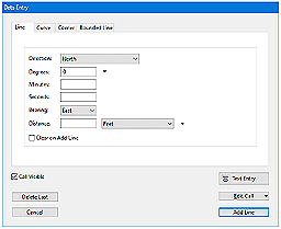
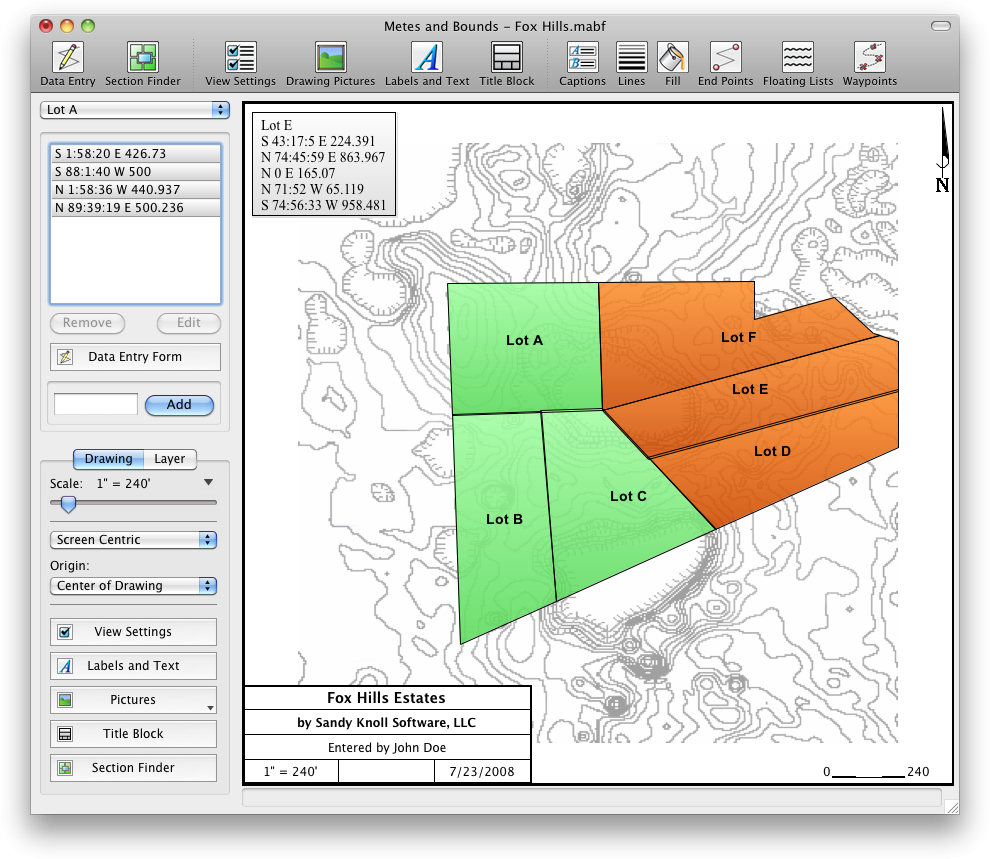
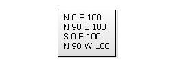
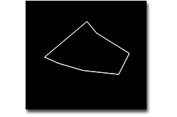
Enter lines, curves, azimuths, compass points and section calls. Data can be entered using the convenient Data Entry Form or freehand using word processor style entry. Deed plots can also be easily drawn by hand using the call drawing tool.
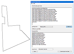
The software can pull most calls from a legal description. Just load the description text into the Deed Cleanup Tool and the software will enter the calls for you automatically.
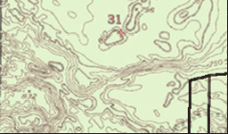
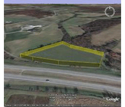
Background pictures can be set to scale with your plot drawing. Background picture scale settings can be automatically set using World Files.
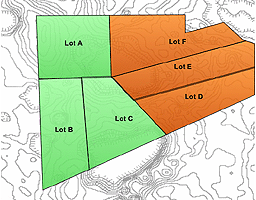
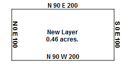
Layers allow you to have multiple lots plotted on a single drawing. Layers can be free floating or locked to a common starting point.
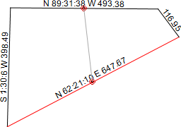
Enter the latitude and longitude for a plot's Point Of Beginning (POB) and the software will calculate the latitude and longitude for each of the other end points. A plot's POB lat/long can also be set by UTM datum or World Files.
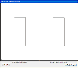
The deed plot closing error analyzer tool can look for common entry or survey errors and offer suggestions on how to correct them.
Subdivide the plot by hand, or choose a starting point and let the software find the nearest halves automatically for you.
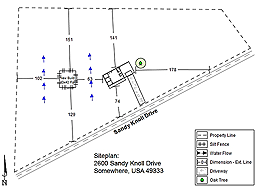
Create detailed site plans from your deed plot drawing. Setbacks. Dimension Lines. Automatic legend creation.
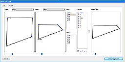
Layers can be easily merged into a single layer using the Merge Layer Tools.
Create drawings from section data. Section data can be converted to metes and bounds calls.
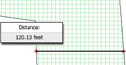
Measure the distance between any two points on the screen.
Each line can be automatically labeled with the length and call. End points can be marked for easier recognition. End points can also be labeled with information like the interior/exterior angles and Lat/Long coordinates. Custom labels can be rotated in any direction. Search feature can be used to find which layers contain which labels.
Square Feet, Acres, Hectares, perimeter distance and more.
Plot Closing Errors
Calculate closure errors: closing error ratios and the call needed to close the plot. Apply Compass Rule Adjustments.
If you're missing the final segment of your legal description, let the software find the call for you. Have a bad or missing call? Enter a question mark (?) for the call and let the software find the missing call for you. Close drawings using Bearing-Bearing Intersections or Distance-Distance Intersections.
If you're missing the final segment of your legal description, let the software find the call for you. Have a bad or missing call? Enter a question mark (?) for the call and let the software find the missing call for you. Close drawings using Bearing-Bearing Intersections and Distance-Distance Intersections or Compass Rule.
Lot drawings can include call lists, endpoint lists and layer information lists.
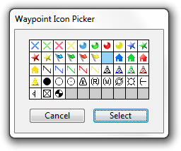
Use custom X,Y points to mark and label unique land features on the deed plot.
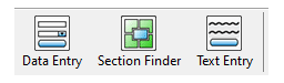
Create an interface that fits to your workflow.
Exporting: Deed Plot data can be exported as DXF files, KML Files, CSV files, Shapefiles(.shp) and more. Export real-world X,Y coordinates for integration with other mapping software such as CAD or GIS software.
Importing: Deed Plotting data can be import from many types of DXF files, KML files, CSV files Shapefiles(.shp), GeoJSON and more. Call lists can be formatted for importing or exporting from Metes and Bounds with other deed plotting software such as Net Deed Plotter® by Greenbrier Graphics, LLC.
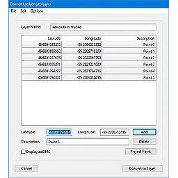
Convert a set of X,Y data points or Latitude/Longitude coordinates into a list of deed plotting calls. Calculate values such as the distance between two waypoints. Add GPS waypoints and tracks to your deed plots.
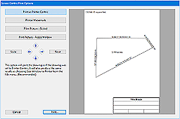
Land plot printouts can include items such as drawing borders, a north arrow and a customizable title block.
Sandy Knoll Software, LLC's Metes and Bounds software can be found in Genealogy Online For Dummies® - 5th Edition, by Wiley Publishing.
|
Download Metes and Bounds
Land Plotting Software |
|
|
|
Windows
Download For Windows |
|
Purchase Metes and Bounds Land Plotting Software |
||
| Free Edition |
Free |
Click one of the download buttons above. |
| Basic Edition Does not include curves, multiple layers or waypoints. |
$39.95 |
Purchase |
| Basic to Pro Upgrade Add curves, multiple layers and waypoints. This option requires that you already own the Basic edition. |
$40.00 |
Purchase |
| Pro Edition Includes all features. |
$79.95 |
Purchase |
For more information, email: support@sandyknollsw.com

Metes and Bounds is Copyright © 2001-2025 by Sandy Knoll Software, LLC